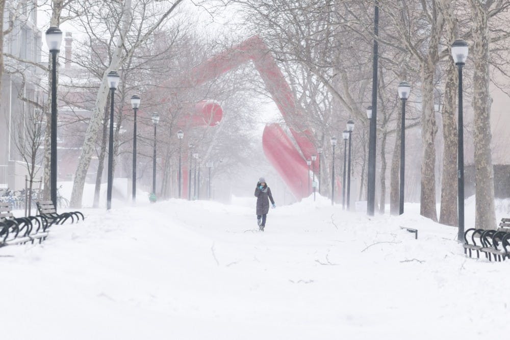
Philadelphia has three chances of snow between today and next weekend.
The first chance of snow will come Sunday night into Monday as a weak storm slides across the Midwest and into the Great Lakes region. It will be cold enough in our area to start off as snow, but will eventually transition to rain since we are on the “warm side” of the storm. However, there is still a question on how much snow will accumulate before we see temperatures warm up. The farther north that you go, the more likely you are to see upwards of 5” of snow. As you get closer to the city, our chances of snow sticking decrease.
Right now, I think it is probable that Penn could see a brief coating to as much as an inch overnight Sunday. Although, it looks as though most of us will wake up to wet weather rather than white.
The second storm that could bring us some snow looks to be similar to a coastal storm, which comes up the Eastern Seaboard and provides the area with snow. This looks to have a little more in the way of cold air in place, meaning that a changeover to rain may not be that much of an issue. The problem with this system is whether or not it will come close enough to affect us. If there is too much cold air in place, storms may not be able to come within reasonable distance of the East Coast because High Pressure can push it southward instead. Right now, it’s too early to determine which way this storm will play out, but I am more confident in seeing snow out of this system than Sunday night.
Lastly, the third chance next weekend appears similar to the first storm system, but is even farther in the future, so I am not confident about saying which solution will come to fruition. The point is that there are multiple chances for snow over the coming days, with no shortage of cold air. The question is now: can we get the cold air to time itself with a storm?