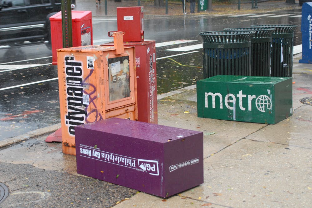
Oct. 28, 2012 was a gloomy Sunday on campus. Emergency relief teams drove by on ambulances, students piled into Fresh Grocer to stock up on food and the administration had already notified everyone that two days of classes were called off.
Hurricane Sandy was by far one of the most powerful hurricanes to ever hit the Eastern seaboard in recorded history. With its three-year anniversary having passed on Thursday, it’s only appropriate to look back and understand how significant this event was.
That Sunday, as Hurricane Sandy barreled up the coast at around 15 mph with maximum sustained winds of around 90 mph, forecasters like myself knew that this storm was not to be taken lightly. Though Penn’s campus managed to make it through the next few days with only a few overturned trees, the rest of the coast wouldn’t be quite as lucky.
Evacuations had already started in many parts of our area, including the Jersey Shore and low-lying areas of New York City. As much of the area prepared for the worst, I’ll never forget sitting on my patio outside and feeling the small droplets of rain hit my face as the wind gusted to a calm 10 to 15 mph.
But just 10 hours later, Hurricane Sandy propelled towards the East Coast pinpointing Atlantic City, New Jersey as its landfall target. The night of Oct. 29, 2012 is when Sandy struck the United States with incredible force. Winds approached 80 mph within the city while areas to the south and east of the center, like Delaware and Maryland, received the brunt of the rainfall. All through Monday night, a huge chunk of the area looked like a scene out of an apocalyptic movie. Facades flew off of houses, 8 million people were left without power, school and businesses were shut down or destroyed and 15,000 flights were delayed. Hurricane Sandy had been a worst case scenario for the Philadelphia area.
The magnitude of this storm was historic. Thousands are still rebuilding, but most have fully recovered from the damage. Sandy cost the government over $60 billion in damages and over 200 deaths in seven countries. This would become the second costliest hurricane in the U.S. behind Hurricane Katrina.
This horror story started on Oct. 22, 2012 when Sandy became a tropical depression, simply a nuisance to those in Jamaica who have seen much worse. Late that night, low wind shear and warm waters allowed for this tropical depression to become Tropical Storm Sandy. Trekking northward as a weak Category 1 Hurricane, Sandy barreled through Cuba. This is when forecasters started to worry about what Sandy would do.
On Oct. 24, 2012, an eye of the storm formed, though it was still considered Category 1 status. A few days later while tracking north east, Sandy strengthened to a Category 2 hurricane off the coast of the southern U.S. Now was the time for federal officials and Penn President Amy Gutmann to hover the hand over the panic button.
What made Hurricane Sandy a disaster waiting to happen? Well, for starters, it was not just a hurricane. It was a hurricane wrapped around a strong nor’easter. In meteorological terms, this is known as a hybrid storm. The wind field stretched over 1,000 miles in diameter, covering a third of the U.S. Plus, the barometric pressure — which indicates a stronger storm the lower it is — was the lowest-ever pressure recorded in the Eastern U.S. at 940mb or 27.76inHg.
But why did Hurricane Sandy make a sudden sharp left turn instead of just heading up the coast like a normal storm? The answer lies out in the midwest. An upper level disturbance dragged Hurricane Sandy westward quite rapidly. The first global computer model to pick up on the shift in track was the European model. Its superior algorithms allowed it to understand the “big picture” and see that Sandy was not just going to go up the coast.
The most horrific story I heard coming out of New York City was of a hospital that had no backup generator lost power, leading to the evacuation of 200 people Monday night. There were other stories of nurses running down flights of stairs with babies in their arms and firefighters who could not enter houses down the Jersey Shore, leaving the community devastated. The pictures I saw of friends’ houses and of areas with fallen trees and power lines made me feel like I had gone through nothing. I had stayed up all of Monday night after losing power around 8:15 p.m. and emptying water from a failing sump pump in my basement.
The most powerful image of the whole storm, though, must’ve been when I went to open my nonfunctioning garage door only to find downed trees in my yard, transformers exploding in the distance and wind that was absolutely unbearable to stand in. As the night wore on, conditions worsened and finally let up around noon on Tuesday, Oct. 30, 2012. Sandy had moved away from Penn’s campus and towards Canada, leaving millions to clean up after the damage.
Elyas Tecle is a College freshman and meteorologist reporting on weather for The Daily Pennsylvanian.


